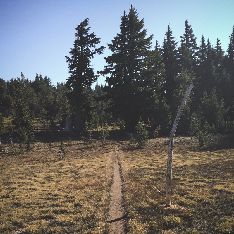
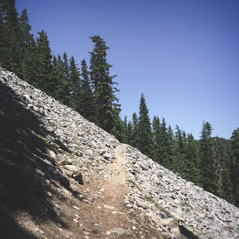
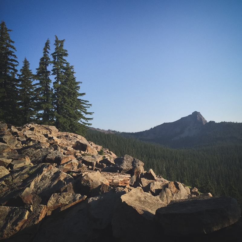
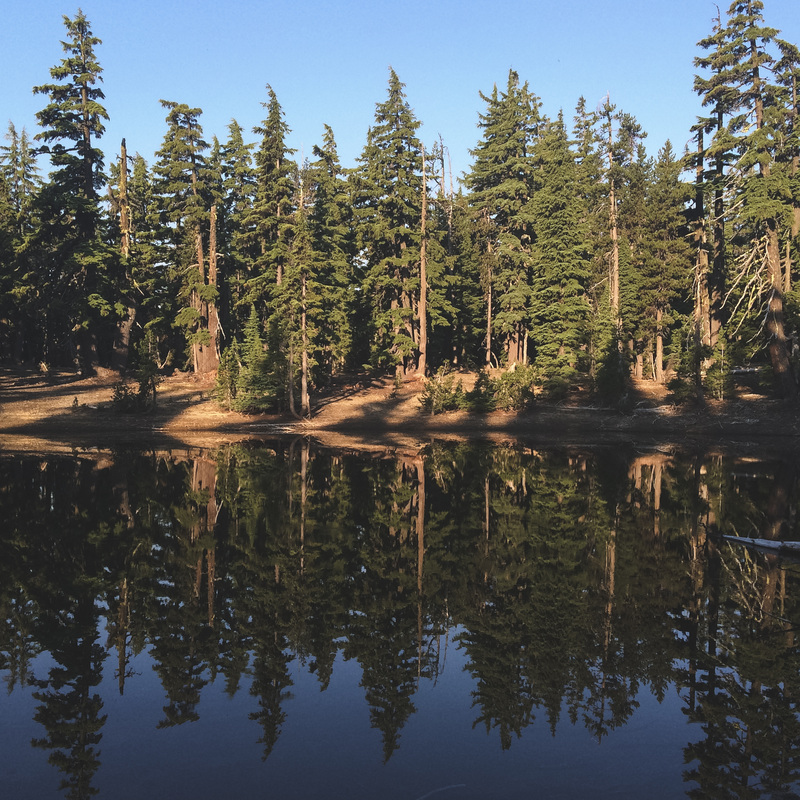
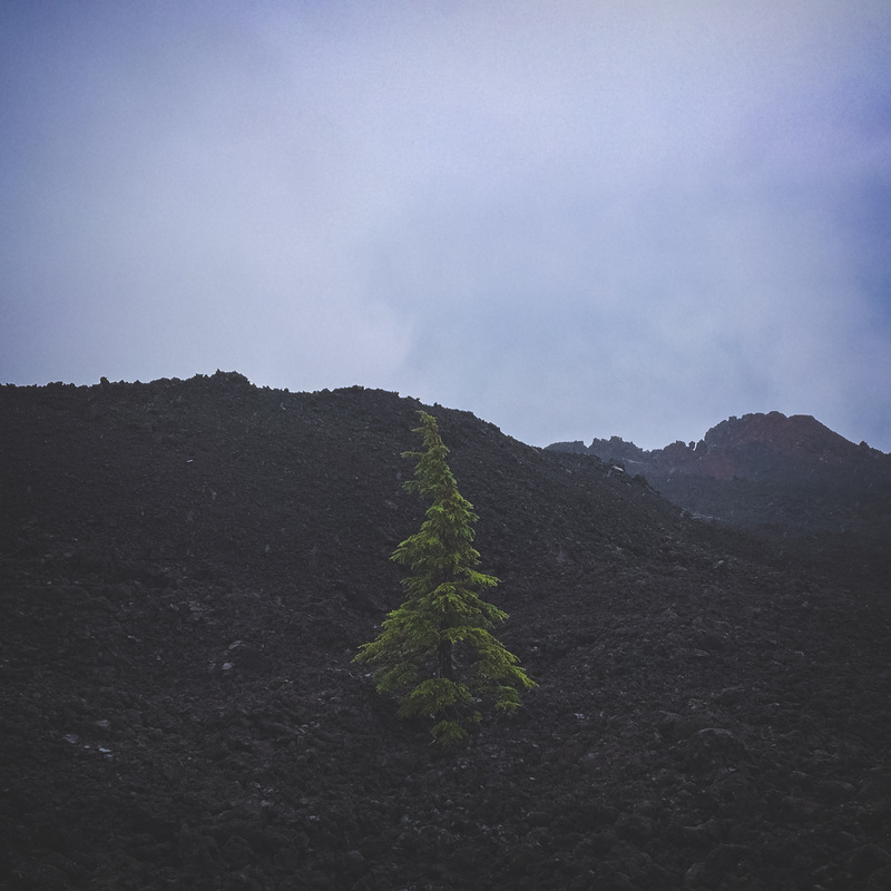
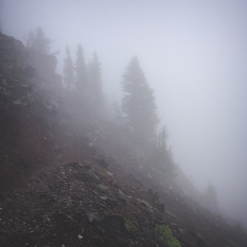
Mitchell Shane
  • Videos
  • Photos
  • PCT: Oregon
  • PCT: Washington
  • TGOC: Scotland
  • Writings

PCT: Oregon Video Recap

11/2/2017

0 Comments

 
0 Comments

PCT: Oregon Post-Trip Photo Summary

9/22/2014

5 Comments

 
Picture
PCT: Oregon Day .5
This is how the trip started. After spending a fair amount of time meandering along unimproved forest roads, we located the point where the road intersects the PCT. From here, a jaunt south on the trail towards the California/Oregon border to officially get the trip underway. It was hard to understand the magnitude of the entire trip at this point, but I was eager to get underway. My wife? Not so much. It was an eerie/exciting feeling watching the car billow away from me down the dusty road as I took the first few steps of what would be an incredible experience.

PCT: Oregon Day .5
After just a few miles of trail, I was already being rewarded in a big way. These glimpses of the Cascade Mtns were beautiful. My brain was starting to wind down and get accustomed to it’s new surroundings and stimuli. This first taste of the trail before starting with larger miles in the morning was perfect. The weather was perfect, the trail was beautiful, and my spirits were high. A calm breeze blew all afternoon and evening. I moved along ridges, draws, saddles and valleys just long enough to wake my legs up and prepare them for the coming days. Welcome to the mighty Pacific Crest Trail.
Picture

Picture
PCT: Oregon Day .5
My first camp. It was fantastic. At about 6,000 feet, a cool breeze made for an extraordinary night of stars and silence. Once chores were complete around camp, I laid in my tent and examined my situation. I remember watching the tent walls lightly move in the breeze as I thought about this exact place. I wondered how many others had camped in this general area, if any. I tried to appreciate that the beauty and solitude that I was enjoying at that very moment was generally always there, regardless of an individual being present to experience it or not. It was a humbling first night, in a powerfully good way.


PCT: Oregon Day 1
My first official day on the trail started very much like the first. Cool winds moved up these gently sloped meadows just quickly enough to be audible as they moved through the trees. Mountain springs bubbled out of the sides of draws and valleys, providing just enough water to slowly fill up a water bottle. I took these for granted the first half of the day, as they were more than plentiful. As they day wore on, my elevation continued to drop steadily. As a result, temperatures began to climb.
Picture

Picture
PCT: Oregon Day 1
The next half of day 1 was HOT. The trail meandered around some interesting mountain areas and eventually dropped down and went under I-5. The terrain became increasingly dry as I continued down towards the highway south of Ashland. It was there that I met my first group of "trail angels”. These are avid supporters of all varieties of thru and section hikers, and their drive is to do anything they can to ease the sting of the trail. An apple and some OJ tasted SO good in the heat. One of the ladies was in her 70's and has been hiking the trail for MANY years. People are awesome.

PCT: Oregon Day 1
As the heat continued to climb throughout day 1, I took my shoes off at various increments. Putting my shoe-less feet up and off the ground seemed so luxurious at the time. Only about 35 miles into the trip, I was already experiencing some issues with abrasion on my heels. I knew that ignoring the problem would only compound it, so I tried to be as attentive as possible. As a bonus, a little butterfly became my first friend on the trail; a heavily contested title that was nearly won by the large man wearing nothing but a flesh colored speedo as he barreled up the trail in the opposite direction. I’m still haunted by that man.
Picture

Picture
PCT: Oregon Day 1
Day 1 was a 25 mile day. It also proved to be one of the hottest experienced on the entire trip. I was BEAT. I wasn’t too picky regarding my camp location for the night, any place with flat ground would do. I ended up near a dry creek bed just 100ft off the trail. After eating and hanging my remaining food from a tree, I laid in my tent and verbally abused noisy squirrels who made it difficult to sleep. Of course, I was being overly dramatic, and was able to fall asleep for the night around 7pm. Before slipping asleep, I was joined by a large group of wild turkeys who were passing through, likely also on their way to bed for the night.


PCT: Oregon Day 2
Today started out with this incredible sunrise as I began to climb up in elevation towards the Hyatt Reservoir. The clouds were welcome and plentiful. Although I obviously understand it’s value, me and the sun are sworn enemies. This was an excellent way to start a day.
Picture

Picture
PCT: Oregon Day 2
One thing I was excited about regarding this trek was the ability to see the landscapes change over larger distances in Oregon. And have they ever. This was taken in the earlier a.m. of day 2 on the trail, before my surroundings got much, much drier. I loved seeing all of these broken pieces of former giants, still contributing to the beauty of the forests. I couldn’t help but imagine the circumstances that brought them down years ago. Did I miss an incredible lightning storm? Howling winds? A period of heavy snow? I was fascinated by the history that each small parcel of land contained, making me want to be present as often as possible.

PCT: Oregon Day 2
Once I pulled myself up to Hyatt Reservoir I needed to get across the lake to pick up my first ReSupply box. After selecting a camping area, I walked along the road and was able to hitch a ride for the last few minutes. After a brief chat with the friendly shopkeep, I walked back to camp along the water-starved shores with another 2 days worth of food to retire for the night. At this point, I was already eating roughly 4,500 calories per day. I felt like I was a steam train laborer tossing individual napkins into the furnace hoping that it would keep the train moving; and somehow, it was.
Picture

Picture
PCT: Oregon Day 3
Bridges were plentiful along the trail. All varieties, all sizes. This one addressed an area of Grizzly Creek that would have been difficult to cross otherwise. This bridge was built to be stout and long-lasting. I stopped to admire the amount of time it must have taken to construct, with 2x4’s laid on edge stretching the entire length of the span. This turned out to be a great resting spot, as all types of waterfowl were perusing the area for easy meals.


PCT: Oregon Day 3
These fallen trees are everywhere, some falling in very large groups, requiring a fair amount of scrambling to move past them. It's interesting to examine the varying stages of decay of these beasts as earth slowly recycles them. Nature seems to always create and sustain the most beautiful pieces of art.
Picture

Picture
PCT: Oregon Day 3
This may not look like much, but it was to me. I had just drank the last of my water a few miles prior to reaching this point. My water source planning had been mostly accurate up to this point, but I was really counting on this source. Almost 13 miles north of any good water sources near the trail, Big Springs was a much anticipated refuge. A long boardwalk led to this spot, where a pipe directed a continuous flow of cool, refreshing water. This was a great opportunity to let my feet “breathe” as I filtered another 2 liters of water for the final push to the Brown Mtn Shelter.


PCT: Oregon Day 3
Day 3 also revealed some amazing trail. I don't know what it is about trails like these, but to me, they do nothing but invite. This “Old Man’s Beard” moss was draped over the trees like a gaudy Christmas Tree store display with far too much tinsel. During morning and evening hours, the moss captured the light like nothing else, giving entire areas an ethereal glow that you were almost forced to stop and appreciate.

Picture

Picture


PCT: Oregon Day 3
My destination for day 3, Brown Mtn Shelter. This inviting bastion of apparent warmth would be a welcome destination in the wintertime with its large interior wood stove. I opted to stay inside rather than in my tent. Although temps were comfortable, I couldn't help but build a fire and wind down the day by candlelight. I thought I could perhaps adopt this simple lifestyle, but only for a moment. I missed my wife desperately.


PCT: Oregon Day 4
Much of day 4’s miles meandered through these rock flows towards fish lake. The red rock is brought in and laid over sections of existing rock to eventually create a surface that’s easier to travel on. Because the Pacific Crest Trail is also used regularly by people traveling by horse, the maintenance of these areas become critically important. Interestingly, packhorses 
are used extensively to transport this type of filler material throughout the PCT. I don’t claim to know why this rock is used specifically, but I’m glad it is. The trail becomes well pronounced and alluring as it curls through the almost endless piles of rock.

Picture

Picture

PCT: Oregon Day 4
Along the trail, I was constantly identifying and reeling in landmarks throughout the day. It was great to see the view in front and behind me constantly change. Places I’ve already been disappeared behind me as landmarks north of me became larger and more prominent throughout the day. Mt. McLoughlin was my focal point for a large majority of day 4. This was taken from the lava flows of Mt. Brown before dropping down in elevation towards Fish Lake.


PCT: Oregon Day 4
After backpacking for days through beautiful landscapes, a walk along the road is everything but desirable. I missed the trail to Fish Lake and ended up taking the Highway instead. I didn’t have any luck getting a ride this time around, which probably would have been a waste of the driver’s time anyway considering that it was just a few miles down the road. Perhaps the drivers sensed my inescapable stench as they approached me. In hindsight, it would have been pretty selfish of me to permanently ruin the atmosphere in their car just to save me from a few miles of highway travel.

Picture

Picture

PCT: Oregon Day 5
Today, my destination was within the Sky Lakes Wilderness area, one of many areas that I would like to return to as soon as possible. The trail snaked around and over some incredible ridges with panoramic views of lakes and valleys for miles. Now I don’t want to cry wolf here, but I would like to cry bear. Just a few miles before this picture was taken, as I was climbing up one of the final ridges by Devil’s Peak, I heard a very distinct growl come from the thick foliage to my left. I didn’t see anything, and I certainly can’t prove it, but if I were to make the noise a startled bear might make, it would sound exactly like what I heard. The conditions were well suited for an encounter like this, as I was on a fairly narrow and exposed section of trail, it was beginning to rain, lightning was striking in the distance, and I hadn’t seen a soul in the last 25 miles. I stood frozen for a few moments and had to laugh a bit at my situation. I was completely vulnerable.

PCT: Oregon Day 4
After traveling to Fish Lake Resort, my planned stopping point for the day, I took great joy in eating ALL OF THEIR FOOD. I took a shower and did laundry as well. I felt like a real gem sitting in the laundry room wearing my tank covered in cat faces that my wife picked out for me prior to the trip. After eating and chores were done, I discovered that I wasn't content sitting idle, so I set out to gobble up more trail. I raced up this hill as the sun was setting just in time to snag a spot amongst the trees. Goodbye Fish Lake.


Picture

Picture
PCT: Oregon Day 5
The climb and traverse on and near Devil's Peak were made extra special by the rapidly approaching thunderstorms. Speaking of thunderstorms, they were supposed to end at 5. At 7, I felt like it was safe to remove the tent-fly again and restore my preferred setup for sleeping. Thunderstorms were NOT finished. Here's your task. Picture this tranquil scene with 4 main differences...
1. It's 12:30 am
2. The fly is OFF
3. It's pouring rain
4. I'm in my underloons running around getting destroyed by mosquitos and soaked by the rain trying to get the fly back on.
You win this time, Devil's Peak.

PCT: Oregon Day 5
This was the scene at my last camp before heading to Crater Lake for a much needed rest day. In between spells of rain, I spent a fair amount of time sitting on a perfectly placed log enjoying the show as it unfolded before me. When this photo was taken, it was perfectly calm. All I heard was the trickle of a nearby stream and various birds chit-chatting about who knows what. With 5 full days and well over 100 miles of trail behind me, I couldn’t believe how fast the time and distance were already going. I got my first sense of urgency, knowing that I needed to make a conscious effort to appreciate every moment given to me as thoroughly as possible. This was one of those moments that I tried to absorb and store.
Picture

Picture
PCT: Oregon Day 6
Onward to Crater Lake. I really enjoyed these burnt forests on my way up to the crater. I thought about the cleansing nature of fires. At this point, I had already seen so many different stages of post-burn areas. This one was just starting to show signs of life again, while others were in full swing towards a refreshed landscape. In the past, I normally viewed these type ofareas with pity and sadness, but this trip completed my newly adopted impression. They really are beautiful, especially when the ground cover has begun to spring up in competition towards the sunlight. I got to see a glimpse of one of the slowest races available to our eyes…a race to dominate the upper canopy and thrive as a large tree.

PCT: Oregon Day 6
Out of the burnt areas and back into the dense forests, glimpses of Crater Lake landmarks became exciting. The prominent point here is Union Peak, which is within Crater Lake National Park. It was quite warm today heading up to the crater, and water options along this section were fairly limited. This section of trail wasn’t necessarily difficult, but the combination of my depleted body, the heat and lack of sufficient water made this a fairly trying day. Before heading up to the crater, I diverted to Mazama Village to rest and replenish my fluids. I wondered why the hostess at the restaurant placed me in the back corner as far as possible from other patrons, but once I sat down long enough for my stench to catch up to my nose, I completely understood.
Picture

Picture
PCT: Oregon Day 6
I’m a bit embarrassed that I didn’t get a better photo of Crater Lake, but it was beautiful as usual. At nearly 2,000 feet deep, Crater Lake is the deepest lake in the USA. Estimations suggest that, after the caldera cooled enough to hold snow and water, it could have taken 720 years for the water to reach current levels. Because the lake has no inlets or tributaries, the water is incredibly clear. Additionally and perhaps often overlooked, hydrothermal activity still takes place along the lake floor, meaning that the future of this beautiful anomaly of nature is all but guaranteed. (I took my tourist role pretty seriously while passing by the lake, and was sure to read every pamphlet available)

PCT: Oregon Day 8
Today was the day I felt like Gandalf the Grey. The peak in the distance was my destination for the day; Mt. Thielsen, the lightning rod of the Cascades. It was difficult to say goodbye to Jesse for another week after an excellent 0 (rest) day, but, with a great deal of foot maintenance and rest, I was eager to uncover new sections of trail. This 25 mile section of trail was a unique stretch, as it was the longest portion of trail the entire trip without any type of water source. I “cameled up” and brought close to 4 liters of water.
Picture

Picture
PCT: Oregon Day 8
I've climbed this Mtn a few times before and have always thought this little parcel would make an exceptional camp spot, committing to return at some point to find out for certain. Sure, I had to backpack 160 miles to get here, but here I was. It was exciting to start seeing landmarks I'm more familiar with as I continued north. Once chores were complete, I enjoyed a sunset I’ve been wanting to experience for quite some time. It didn’t disappoint. Once the moon replaced the sun, a group of coyotes serenaded me from somewhere up on the ridge.

PCT: Oregon Day 9
After a wonderful nights rest at the base of Mt. Thielsen, I woke up to a steady breeze that carried with it the smell of smoke. Looking north, a haze had developed due to the numerous wildfires that were taking place in Oregon. I wouldn’t have to deal with these for quite a few days, but it reminded me that a person can only control so much. This photo was taken from Thielsen Creek on the north side of Mt. Thielsen. It was my first water stop in 27 miles. I drank until I puked, and then drank some more. I laughed at myself and decided that I had picked a pretty amazing place for a puke rally.
Picture

Picture
PCT: Oregon Day 9
Today was another very hot day. I only had about 20 miles to complete, but the constant onslaught of the heat and sun made it difficult. Little parcels of shade like the one pictured up this trail were in high demand. Luckily, I didn’t have any competition for these spots. Generally speaking, the sun wasn’t a huge issue in Oregon overall. Large-ish clearings like this one were pretty rare, as most of the trail snaked through dense forests, providing plenty of shade. To my delight, the sun was apparent via ground-seeking rays through thick forests far more often than the searing presence I usually associate it with. This was a welcome discovery along the trail.

PCT: Oregon Day 9
My destination for today was Six Horse Spring, a water source that I had circled on the map previously. During the hot day, I conjured up visions of a grand shaded cascading waterfall next to a group of wild horses that called the area home. By the end of the day, this vision continued to become more and more exaggerated as I grew increasingly tired. This little wish of mine didn’t come true. Although the water was perfectly acceptable for drinking, it was far from what I imagined. Normally, the hike down to the spring would have been a pleasant jaunt, but I was absolutely exhausted. After switchbacking my way down to the source, I filled up my bottles with the scant trickles of water and put my feet up for a few minutes. Later, I hauled myself back up to the trail and stumbled further north until I couldn’t go any further. I reluctantly pitched my tent right along the trail and slept the rest of the afternoon and evening.


Picture

Picture
PCT: Oregon Day 10
Fully rested and excited to get to Summit Lake, day 10 started well before the sun starting climbing up from behind the mountains. The previous night was interesting, as I was awakened two different times by the sound of massive trees crashing down onto the forest floor. The earth shook, and I bolted up each time and examined my surroundings to be sure that wildfires weren’t blazing nearby. It was an eerie feeling, as hearing one tree crashing down in the woods is uncommon enough. Perhaps a pair of mischievous beavers wanted to ensure that I had a restless night.


PCT: Oregon Day 10
As the trail took me through a variety of new areas, my innate need to climb everything I see was difficult to squelch. There are so many neat and picturesque peaks along this trail! Although this one doesn’t really compare to the one in Idaho, Sawtooth Mtn is a neat little peak with fantastic views of Crater Lake and the surrounding areas that I’d love to return to and scramble up someday.
Picture

Picture


PCT: Oregon Day 10
Although this setting was amazing, the water you see functioning as a mirror in this picture was shallow and warm, yet the only source of water I had for a fairly long stretch of trail. After treating and filtering it, it was completely safe to drink, but absolutely disgusting. I think the situation was compounded by the barrage of mosquitos I faced during the filtering process.


PCT: Oregon Day 10

Speaking of mosquitos, the last 10 miles down towards Summit Lake was a full-blown infestation. My patience was tried in a big way as I assumed the role of a beekeeper with no protective equipment. Long sleeves, pants and a bug-net didn’t matter. They were piled layer upon layer on my clothes and seemed to all possess probes as long as sewing needles. It was miserable, and if they all just happened to work for the Red Cross, I would have gotten piles of “I donated today” stickers.
Picture

Picture
PCT: Oregon Day 10
This spot beside Summit Lake was special. After a trying few hours through legions of hungry mosquitos, I found a peaceful spot next to the water. As far as I could tell, I was the only one along any of the shorelines. I spent some time tidying up a few wounds and had a relaxing dinner. It felt so great to wade out in the water and relax for the remainder of the day. It was so quiet. I watched and listened as large hawks hurtled their way through large stands of trees and over the water as they surveyed their dinner situation for the evening. I slept wonderfully here, and woke up to a fantastic layer of fog over the lake.


PCT: Oregon Day 11
After reluctantly leaving the shores of Summit Lake, I began my push towards Shelter Cove. It was today that I’d pass my 200 mile mark for the entire trip. The first portion of the day took me past a multitude of small lakes and lakelets, almost all with an surreal and mysterious layer of fog over their waters. The large number of frogs croaking in unison kept me company for this segment of trail as I headed towards the snow-capped mountain known as Diamond Peak.
Picture

Picture
PCT: Oregon Day 11
The second half of day 11 took me through parts of the Diamond Peak Wilderness. The water from these mountain peaks is so cold and refreshing, it almost made up for awkwardly walking over snow in trail running shoes for half the day. Diamond Peak was a neat mountain to be around. It’s open and exposed south face was begging to be climbed and explored. Unbeknownst to me at the time, if I were to summit Diamond Peak and look north, I would have had an excellent view of Waldo Lake, my endpoint for the week.

PCT: Oregon Day 11
After dropping down from snowy Diamond Peak, my sights were set on the Shelter Cove Resort. I took these railroad tracks for nearly a mile to the access road ahead. At the road, I met a couple fellows who were examining the tracks very closely. After chatting for a bit, I learned that they returned to the area to “reminisce” about an incident one of the men experienced many years back. For whatever reason, while passing through a railroad tunnel barely behind where this photo was taken, the man fell off of the train, bounced off the wall and onto the ground. He had to wait for the entire train to safely pass over his bruised body before getting up and attempting to collect himself. He and I couldn’t believe that he managed to survive such an ordeal, considering how narrow the tunnel was. With good reason, he still seemed a bit uneasy telling the story.


Picture

Picture
PCT: Oregon Day 11
Shelter Cove Resort didn’t have a restaurant, but they did have food. I ordered 2 mini pizzas and stuffed my face. I resupplied, showered and did laundry. Although I didn't have soap for either of the aforementioned activities, I still gave it a go. After relaxing a bit, I went further north and settled in at the Rosary Lakes. I had my own cowboy-esque campsite that I can't wait to go back to. One of the gear items I decided not to take along with me on the trip was my harmonica. THIS was the campsite where I would have played it. The huge natural fireplace against the rock would have complimented some harmonica tunes perfectly.

PCT: Oregon Day 11
As the sun dipped behind pulpit rock, large birds began plunging into the water in search of a meal. The whole area was mine to experience. An exceptional evening. There was a chill in the air on this night, making my sleeping that much more comfortable compared to other nights. Once the sun set, the reflected light of the moon bounced off the lake and lit the inside of my tent perfectly. Like so many other places, I glanced around almost frantically, knowing that most of the details that made this moment so special could be easily forgotten. Tomorrow I’d pass the halfway mark for the entire trip on my way to Waldo Lake. As usual, time was absolutely flying by.
Picture

Picture
PCT: Oregon Day 12
Much like highways and freeways, these plaques are placed periodically along the PCT to help hikers verify that they’re still on the trail. It was interesting to see the different ways various wilderness areas were managed. Some areas had these placed methodically every half mile or so, while others only placed them after an intersection so that hikers could verify their trailselection. Older plaques had been all but swallowed by growing trees they were nailed onto many years ago, while wooden versions were nearly too faded and worn to even be recognizable, besides their general shape. At any rate or frequency, I was happy to see these along my trip. They assured me that I was heading home.

PCT: Oregon Day 12
It was hard to leave the Rosary Lakes area. I "slept in" a bit and let the sun warm me in my tent. I had a nice day moving through the Wilamette National Forest. I had an extra measure of motivation for the day because I was approaching another "0" day of rest and recovery. As I approached the Charlton Lake area, I got on a series of gravel/paved roads that brought me to my endpoint for the week, Waldo Lake. Waldo is one of the largest lakes in Oregon, and it's beautiful. Because of its water sources, it's one of the clearest lakes in the region. I spent a fair amount of time relaxing at this outdoor amphitheater as I waited for family to arrive.
Picture

Picture

PCT: Oregon Day 12
As I enjoyed Waldo Lake during another beautiful sunset, the scale of this trip as a whole continued to illude me. Diamond Peak, the snow capped mountain pictured here, was just one day and about 28 miles behind me. It seemed so far away, yet it only represented about 5% of the entire trip. It was only when I looked at a map of the entire State of Oregon that I realized just how far I had actually come. This gave me confidence as I prepared for the next 2 weeks of trail; confidence that would most certainly be tested.


PCT: Oregon Day 15
While trekking along the PCT, there were multiple days where I was able to wake up, hike about 25 miles and bed down for the night without seeing a soul. Being that I wanted this trip to be a solo one, this was a welcomed and unique experience. As my body began to accept the reality of what was expected every day, my mind was more free analyze and process the experience as a whole. I still haven’t necessarily arrived at grand conclusion regarding the trip, besides the fact that I feel extremely lucky to be able to experience it.
Picture


Picture
PCT: Oregon Day 15
After a fantastic weekend of rest and resupply, I forged further north. Although the first half of the day was conducive to a positive and healthy inner dialogue, the second half was much different. With about 4 miles remaining, I developed severe cramps in both calves and my right ankle. It was excruciating to move along the trail, and attempts to relieve the pain were seemingly useless. I’d stop every few minutes, lay on the ground and attempt to thoroughly stretch out the trouble areas, only to stand back up and experience even more pain than before. I probably should have stopped, but knowing that every day’s mileage was critical to the overall trip, I hobbled the last 4 miles in a great deal of discomfort. Once in my tent, being that I overthink just about everything, I feared that my trip as a whole could be potentially jeopardized.
I frantically stretched for hours, and once again, drank water until I nearly threw up. With no more energy to stretch or even stay awake, I slipped asleep fearing the worst for the following day.

PCT: Oregon Day 16
Much to my surprise and delight, I woke up without even a sign of the cramps that were so debilitating the day before. Fearing a relapse, I upped my water intake to 6-7 liters a day, which made drinking water just plain uncomfortable. As I inched closer to the Three Sisters area, landscapes continued to change drastically. I began to temporarily rise above the more pronounced tree lines, giving me great views of where i’d been and where I was heading. I spotted another hiker disappearing over a ridge along this stretch, which gave me an incredible sense of scale. As the loose gravel crunched beneath my feet, I tried to estimate how many steps had taken me to this point. I gave up almost immediately. Math is hard.


Picture

Picture
PCT:Oregon Day 16
I was so giddy whenever I came upon a crisp mountain stream. I treated most of my water before drinking it, but some of the sources seemed too pure to “taint” with my chlorine treatment drops. You know that sensation when you feel a hot drink sliding into every available space in your body on a cold day? These brilliantly clear mountain streams gave me the same type of sensation. I often drank until I was sick, up to 7 litres on some especially long days. This little token is something my wifey sent with me to keep me safe during the trip. It worked.


PCT: Oregon Day 16
In preparing for this trip, I often struggled with my inner-dialogue. I felt like I had done everything I could to prepare physically, but I still wondered if what I did was enough. My wife didn’t experience or proclaim any such doubts. From the moment she gave me the go-ahead, she knew I could do it. Whenever I moved past little displays like this on the trail, I felt the encouragement and confidence of my wife ushering me along. Thanks for the speed-boosts my dear!
Picture


Picture
PCT: Oregon Day 16
As I reached the base of the North Sister, I knew a storm was coming. After taking this picture, I selected a unique perch on top of an obsidian riddled mass of rock and began fortifying the area around my tent. I built a wall almost 2 feet high around the perimeter of my tent to help protect against wind blasts, and stacked rocks over my tent stakes hoping to keep them securely in place. Right after I completed my bastion of a shelter, the storm came hard and fast. Lightning, hail, rain and wind challenged every inch of my tent in mighty pulses of sheer power. I felt like I knew my tent wouldn’t hold, so I sat perched in my shelter for a large portion of the night with my gear packed away and rain gear on. With my headlamp on, I’d spin around monitoring the different stake points for weaknesses as the walls shook furiously. The end result of this trying night was a glowing review of my tent of choice for this trip, the Big Agnes Fly Creek UL2. Color me impressed.

PCT: Oregon Day 17
After a trying night at the base of the North Sister, the following day wasn’t the relief I was hoping for. I sprung into action during a short lull in the rain to get my tent and gear put away and then headed north towards Mt. Washington. The rain came down hard and sideways the entire day. I usually welcome the rain while backpacking, but today was different. There was no cover from the relentless rain for the majority of the day. As I plowed my way over the never-ending lava flows climbing up to Big Lake, my mettle was tested. My rain gear became useless and functioned better as a cape than protection from the elements. I think I would have really enjoyed the change in terrain today in any other conditions, but not today. This tree, on the other hand, was having the best day ever. Good for you, tree.


Picture

Picture
PCT: Oregon Day 17
The inner dialogue I experienced this day was a roller-coaster of emotions. I was a full-blown drama llama. Some moments, I was sure that every rock I stepped on or passed by was the stupidest rock on the planet. Lava was stupid, rain was stupid, everything was stupid. What a stupid place to be. Moments later, I was laughing maniacally at the position I had somehow gotten myself into; out loud, emphasis on the loud. I was losing it. In hindsight, this is the day where I earned my PCT: Oregon merit badge. The day I was able to drone on through extremely uncomfortable circumstances because I knew that tomorrow proposed an opportunity to see something new; experience something different.

PCT: Oregon Day 17
My destination for my 17th day was the Big Lake Youth Camp. I’d heard that they really take care of hikers, and the camp took on a mirage-esque existence throughout the day. I conjured up fallacies pertaining to what they would “surely” have at the camp for a fellow like me, battered and freezing, who just slogged his way through 25 miles of hell on earth. To my delight and unrestrained elation, all of my feigned offered amenities came true! They pulled some strings and put a few of us in a shelter for the night, provided laundry services, showers, and a hot meal with all of these lil’ camp-goers. I wanted to high-five all of the staff until my hands bled, but the most genuine thank-you I could muster had to do.
Picture

Picture
PCT: Oregon Day 18
With a renewed energy and dry clothes, I left Big Lake and headed north. After crossing Hwy 22, I was met by family for a quick warm breakfast and chit-chat before continuing on. It was at this point that I realized my stomach no longer had a limit on capacity. I ate just about everything that was offered. A great start to the morning. Although wet, today was much different than yesterday. It was my kind of rain. As I rounded Three-Fingered Jack, fog was quickly being ferried over the ridge by the wind. It was fantastic to watch as it crashed up, over and down, seeking the path of least resistance. I was elated to be on the trail as I marched onward to my first fire detour.

PCT: Oregon Day 18
It wasn’t long before I reached my first detour. Some small sections of the trail were closed due to fires moving through the area. It seems to be the norm as of late. I separated from the PCT and moved down towards Hwy 22 past Marion and Ann Lake to begin the detour. While traveling through burnt forests such as this one for a fair amount of time, the sound of trees falling becomes fairly regular. Eventually, all of these trees will fall to the ground and lend to the cleansing process that fires started years ago. I don’t mind traveling through these types of areas, as their eeriness provides a feeling not found anywhere else. It was interesting to try and imagine which warriors of the understory would win the growth battle and become a part of the newly formed canopy years down the road.
Picture

Picture
PCT: Oregon Day 18
I don’t know how many Wilderness Areas I passed through, but they all were fantastic in their own ways. As cities continue to grow and the US becomes more populated, I’m thankful that certain areas are set aside and preserved as Wilderness Areas. The Wilderness Act protects nearly 110 million acres, and includes everything from deserts, tundras and canyons to sand dunes, swamps, forests and savannahs. I love how the Act states that (referring to Wilderness Areas) they are “an area where the earth and its community of life are untrammeled by man, where man himself is a visitor who does not remain.” I felt like a “visitor” this entire trek, and am elated to be designated as such.

PCT: Oregon Day 18
The last section of the detour was along this gravel road towards Hwy 22 below Marion Lake. At this point, I was at mile 28 of 31 for the day. Have you ever nearly fallen asleep while walking? I didn’t think it was possible until I nearly did on this last section of gravel. It felt so good to close my eyes just for a moment. I’d eventually see how far I could walk in a straight line with my eyes closed. I had discovered mobile napping. I discovered that I tend to veer left while walking unaided by sight, so slow left turns were a breeze. I feel like I was probably quite cartoon-like as I struggled to put one foot in front of the other while fighting fatigue. Once I finally reached Hwy 22, it was too late to attempt a hitch, so I tucked my weary body up into the bushes out of sight of the passing motorists and quickly fell asleep. Aside from moments of extreme stench, this is the moment I felt most like a hobo while on the trail, my “campsite” was anything but picturesque.


Picture

Picture
PCT: Oregon Day 19
I have driven over the Santiam Pass many times. It has always been a favorite road of mine. The road curves and dives through a dizzying channel cut in the trees up and over the Cascades between Sisters and Salem. What I thought would be a dreadful few miles along the highway turned out to be one of the highlights of my trip. At this point I was over 300 miles into my journey, and felt confident that I’d be able to complete it in it’s entirety. I got emotional thinking of all the trips I’ve taken over this pass in different states of mind. Trips taken while I searched for what I now have, and trips taken while anticipating a great adventure, this road has seen many different versions of me. I was thrilled and honored to show it this one.

PCT: Oregon Day 19
Finally back on the PCT after a lengthy detour, Bays Lake, within Jefferson Park, did not disappoint. I generally search for a campsite like a dog searches for a spot to lie down, which usually results in some pretty amazing views. This amazing natural mirror distracted me as I set up camp for the day. I dangled my feet in the chilly water and attempted to take it all in. By this point, I had seen so many beautiful scenes on the trip as a whole, but this one floored me. I started to hypothesize that it wouldn’t have made nearly as as large of an impact if I hadn’t backpacked 341 miles to see it in person; a theory that was later supported by the sheer elation I felt when the trail became more familiar in the coming days.
Picture


Picture
PCT: Oregon Day 20
I had some company for the “short” jaunt from Jefferson Park to Olallie Lake; my brother and his son. It was a beautiful day peppered with a fair amount of elevation change and varied terrain. As Mt Jefferson slowly got smaller, another prominent peak was growing a bit larger. It was on this day that I saw Mt. Hood for the first time. Finally, I could picture where I was on the map better than ever. Although the last 3 weeks were a bit of a blur at the time, it was at this moment that I really realized how far I’d come. I couldn’t help but smile every time I got a glimpse of Hood, a prominent peak that I’ve stood atop of, recreated on, and used as a landmark for many years. I couldn’t believe that a single trail had brought me to this point. Because hugging a trail is a bit difficult and potentially embarrassing, with a smile, I thanked it privately and silently.

PCT: Oregon Day 21
Although we loved the rustic nature of our Olallie Lake cabin, there were two crucial amenities missing: showers and laundry. I don’t know about you, but I smell absolutely terrible after 120 miles of sweat. Not an “ew, gross” smell, but more like a “my face is melting off of my skull because of the way you are” type of deal. Me and Jesse couldn’t help but laugh as we achieved full-blown hobo status in Head Lake (adjacent to Olallie) the afternoon I arrived. Naturally, because it was a hot summer day, the lake was full of recreating families swimming and sunbathing near the lake. I got in the lake with my ultralight laundry shorts (basically speedo status) and swam around the corner with a bottle of soap in hand. Meanwhile, Jesse filled up a bucket with water and began hand-washing my rank clothes from the previous week. Thankfully, after a thorough wash, Jesse accepted me as her husband once again.


Picture

Picture
PCT: Oregon Day 20
Out of all the moments on the trail, this one was perhaps my favorite. After reaching Olallie Lake and having a nice chat with friends and family, me and Jesse got to enjoy our last 0 day of the trip. We stayed in a perfectly rustic cabin at Olallie Lake Resort. A wood stove, oil lamps and a beautiful lake were all we had, and all we wanted. We played cards late into the night, ate junk food, and talked about the last few weeks of trail. Although it was hardest to say goodbye to my wifey, it was also difficult to leave this cabin behind. This picture was taken after I woke up early to go over maps and fire detours for my final week on the PCT. I had my wife and I had my adventure. A perfect moment.

PCT: Oregon Day 21
My gear was good to me on the Oregon PCT. I’m so glad to took the time to research every piece of gear thoroughly. Out of the 55 (yes, I counted) things I brought with me, there are only 1-2 changes I’d make regarding gear if I end up doing something similar in the future. Is it weird that I don’t want to throw away my shoes for nostalgic reasons? They’re trashed, but they carried me so far! It was pretty special doing my last re-supply at Olallie Lake with my wife. As I tucked the final few map pages into my pack, I thought of how daunting the stack of maps seemed at the beginning. Now all those traveled pages are scattered in recycle bins and trash cans at resorts and towns all across Oregon.
Picture

Picture


PCT: Oregon Day 22
With my last re-supply complete, I joined the trail again towards Timothy Lake. Old shelters like this were plentiful along the trail as a whole, with most of them primarily functioning as warming huts for winter recreators. This one, known as the Olallie Meadows Cabin had a bit of an eerie feel to it, so I was more than happy to move along for the day.

PCT: Oregon Day 22
After a fair amount of road-walking due to the fire detours between Olallie and Timothy Lake, I was about ready to call it a day. I had reserved a campsite at a Timothy Lake Campground, but the noise of all the lake-goers felt like it just may make my brain explode. I needed to get back out by myself. I continued up the trail a bit and took a detour to see Little Crater Lake. It was fantastic. This little spring-fed lake maintains a constant temperature of 34 degrees and is absolutely crystal clear. A great ending to a long day on the trail. After looking at and enjoying the lake from every angle, I continued up the trail and found a small clearing next to a natural spring where I’d bed down for the night.
Picture


Picture
PCT: Oregon Day 23
My first night of my final week was an interesting one. It seemed that others were interested in the spring I camped next to as well. I woke up at about 2am to the sound of quite a few feet tromping and skidding around my tent. I felt like I knew I was safe, but I still didn’t want to make any movements within my feeble little shelter. I laid there for about 15 minutes as the group of animals satisfied their hydration needs and eventually moved away from me, cracking and crunching their way through the forest as they left. I don’t know what they were, but there was a good number of them. When I woke up the next morning, I was eager to check for any prints in the area. There were none that I could find. Was I starting to get delirious, or was the ground around my tent too hard to sustain prints? I really don’t know. The rest of the day was spent reeling in Mt. Hood, an especially exciting quest, being that reaching Timberline Lodge put me just TWO days from the Bridge of the Gods.

PCT: Oregon Day 23
After a moderate climb up to the Timberline Lodge, I wandered the hallways and corridors and enjoyed a lunch buffet full of sheer goodness. I wasn’t staying here for the night, my camp was TBD along the trail running clockwise around mighty Mt. Hood. From the comfort of the lodge, I caught a glimpse of Mt. Jefferson; 70 miles and 3 days behind me. I tried to trace my path over the hills and ridges leading to this point based on my maps I had used the last few days. I was amazed with how seemingly compact the space between the two mountains seemed, yet that space was filled with so many breath-taking variants of beauty.
Picture


Picture
PCT: Oregon Day 23
My second to last perch on the trail. By this point, I had backpacked over 400 miles through some incredibly beautiful areas. Whenever I got to spend the night in a fantastic place like this, I said to myself, “this is definitely my favorite campsite of the whole trip”. Now that I’ve had a month to process the whole trip, picking a favorite spot or moment makes my head hurt. This one was unique though. Although tired from about 28 miles on the trail that day, I sat up in my tent and watched the light slide up the mountain until just the top was lit. Even after the sun was gone, I’d sit up and examine the different light induced moods the mountain had to offer. I love Mt. Hood. It’s not the tallest in the area, but it sure is mighty. I found myself fighting the night at this location. I knew that once I woke up, I’d have to move on.


PCT: Oregon Day 24
The trip around a portion of Mt. Hood was fantastic. There was such an assortment of mini-vistas to enjoy and areas to explore. Water continued to rush from the many glaciers on Hood down into the valleys below. It’s always satisfying to me to be able to view the origin of some of the numerous smaller tributaries that later lend to the larger ones. I was feeling quite proud at this moment, as I was just 20 miles away from my final camp on this unforgettable trip.
Picture

Picture
PCT: Oregon Day 24
Water Crossings. Most of them were easy hops over a small stream or creek, but others were a bit more challenging. It may seem like a simple problem, but it becomes more complicated when you’re by yourself in the sticks with no reception. It was heartbreaking to hear that a hiker got swept into the river and lost his life just 14 days after I’d been through this same general area. After trying a myriad of routes across this section of the Sandy River, I finally found a fallen log about half a mile downriver. I felt like and mimicked a horrified cat as I crossed the slippery log to safety.


PCT: Oregon Day 24
If I were to select a plot of land to build a log cabin on, this would be a front-runner. Just after the ever-popular Ramona Falls near the PCT, this little section of trail had the feeling of a deep slot canyon in Zion National Park, except this one was riddled with foliage and rich layers of soil. It was really remarkable. Perhaps it was that the light was just hitting it perfectly, but I walked a few miles while looking straight up at the enormous walls that encased this perfect little parcel of land.
Picture


Picture
PCT: Oregon Day 24
My last campsite on the trail. I had been afraid of this camp the entire trip. A camp and night that was my last on the trail was something I was reluctant to accept during certain portions of the trip. However, I was completely satisfied with what this camp meant when I arrived. I laid in my tent feeling accomplished and blessed at the same time. I really didn’t know that I’d be able to complete the entire trail, I just knew that I was just going to try. With my hardest days already behind me, I looked forward to an “easy” 25 miles through some of the most beautiful scenery in Oregon the following day. I had most of the evening to myself, but was joined by a slew of eager Boy-Scouts as the sun started to slip below the horizon. On any other night, I may have been a little upset that they encroached on “my” space, but tonight it didn’t matter. I was satisfied and elated with my experience as a whole.

PCT: Oregon Day 25
My final day on the PCT consisted of an especially nostalgic trip down the Eagle Creek trail. This was one of the first trails I went on as a kid that really opened my eyes to the beauty that nature can provide. It has always been a special place for me and I return to it often. I was elated that my final day on the trail could be spent reminding myself where the inherent desire to backpack across the entire State of Oregon could have come from. This photo is taken from inside the tunnel of tunnel falls. To the right and through the tunnel wall, a 130 foot waterfall pours and cascades down and over the tunnel blasted out of the rock. The passageway was formed in the early 1900’s, and incredible feat of engineering. I stood in the damp and dripping tunnel for about 15 minutes; what a great place to be.


Picture

Picture
PCT:Oregon Day 25
Beyond Tunnel Falls, Eagle Creek Trail became very busy. It seemed that many others shared my sentiments regarding the trail. This was a stark contrast to what I had grown accustomed to in the last month. Despite the crowds, I was able to find some repose. Because I needed to cross the Bridge of the Gods at a specific time, I budgeted extra time for this portion of trail. I enjoyed a long siesta next to a recently appointed favorite waterfall. It was so refreshing to wake up to the sound of rushing water. After working my way down to the trailhead, I took a final rest on a picnic table near the parking area. One final and small push to Cascade Locks and I was essentially done. I was ready to accept that the trip was over, I was ready to see my wife.

PCT: Oregon Day 25
After waiting beneath the bridge for a few minutes, it was time to cross. The Bridge of the Gods isn’t very pedestrian friendly. With widely spaced metal grates and no shoulder of any type, I was certainly out of place. I brought along $10 to pay for 10 cars that would follow me across the bridge. I thought that this may keep some of them from flipping me off and forcing me off the side of the bridge. Despite the difficulty of a pedestrian crossing, this bridge is beautiful. It was a treat to be able to walk across it on foot, something I’d never done.
Picture

Picture
PCT: Oregon Day 25
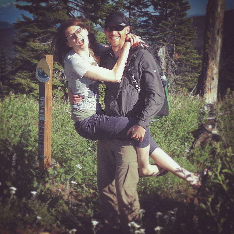
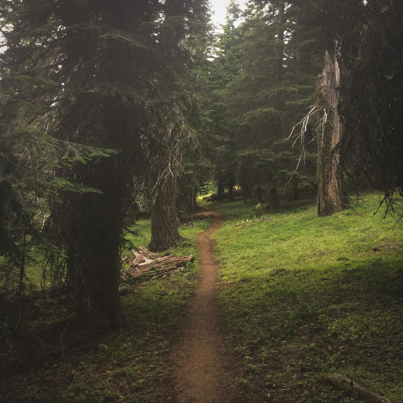
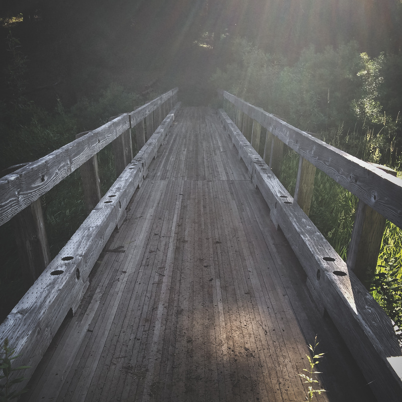
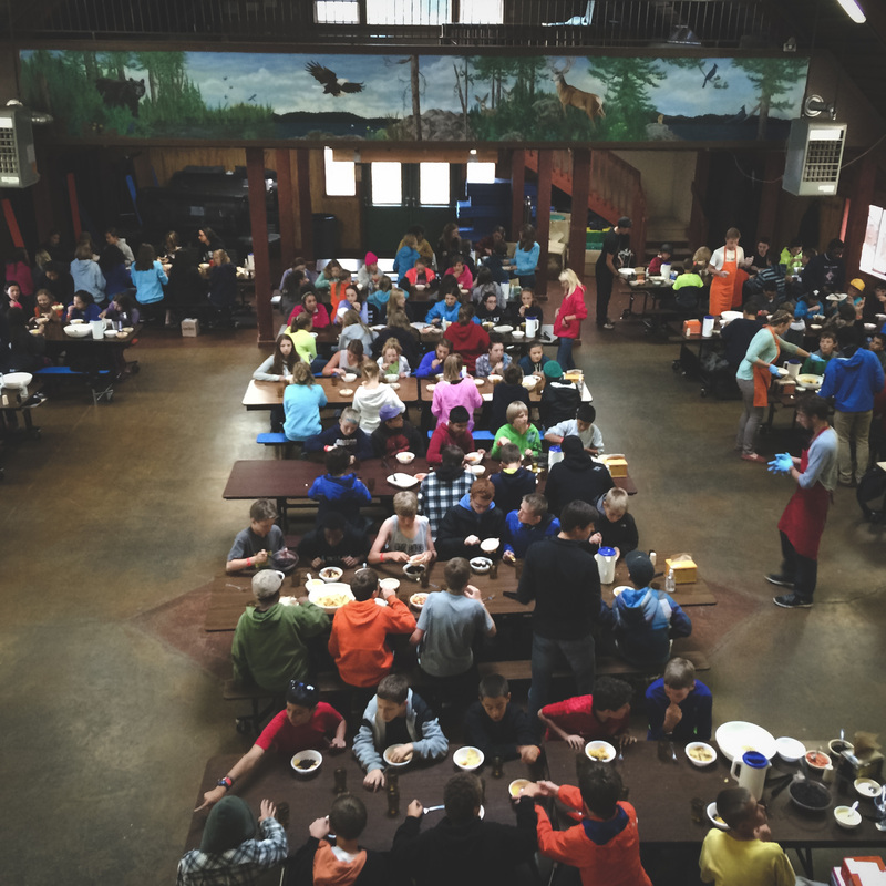
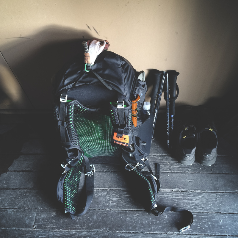
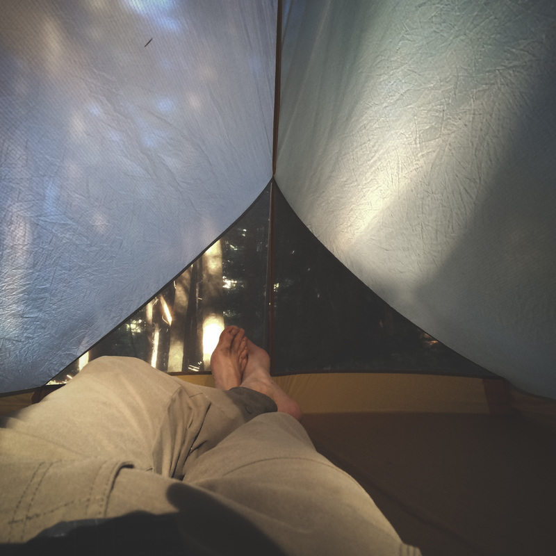
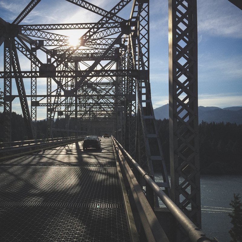
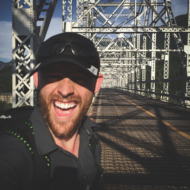
I feel so lucky to have had the support I did on this trip. My wife, family and friends were confident in me from the trip’s inception. That confidence propelled me through some very trying days. After crossing the bridge, I was met by a herd of family and friends. I won’t try to summarize the trip in a sentence or word(s); that will take time. However, I couldn’t help but feel the overwhelming feeling of triumph while finishing. Triumph that extends far before and after the actual trek itself.
5 Comments

PCT: Oregon Gear List (Pre-Trip)

7/1/2014

2 Comments

 
The research and decision making process leading up to my PCT: Oregon conquest has been incredibly time-consuming. Without a doubt, I have spent far more hours planning this trip than I'll actually spend on the trail.  It has been both exciting and stressful all wrapped up into a ball of tremendous anticipation. Things originally thought as "needs" quickly transform into "wants" when their overall weight, size and practical value is considered over a 458 mile trail.  As a result, counting ounces turns into counting grams, and the overall weight of individual items becomes a very high priority.  Because of these realities weighing (pun intended) heavily (again!) on my mind, my final pre-trip base-weight (everything but food/water/fuel) is hovering around just 10lbs.  I am only taking what I NEED, and not much more, and I'm down with that.  

Being that I have just 5 days before I'm dropped off at the trailhead, my time is very limited.  Once I'm back and have acquired some long-term impressions of my gear selection/performance, I'll post some more in depth thoughts on gear.  In the meantime, here's two pictures... One shows all of my unpacked gear I'll be taking laid out, and the other shows my pack loaded and ready to go.

Additionally,  for you gear-freaks, check out my GEAR LIST for details on every piece of gear I'll be taking on the trail.  If you find the embedded list too difficult to navigate, I have made the spreadsheet available via Google Docs as well.  Check it out HERE.  


Picture
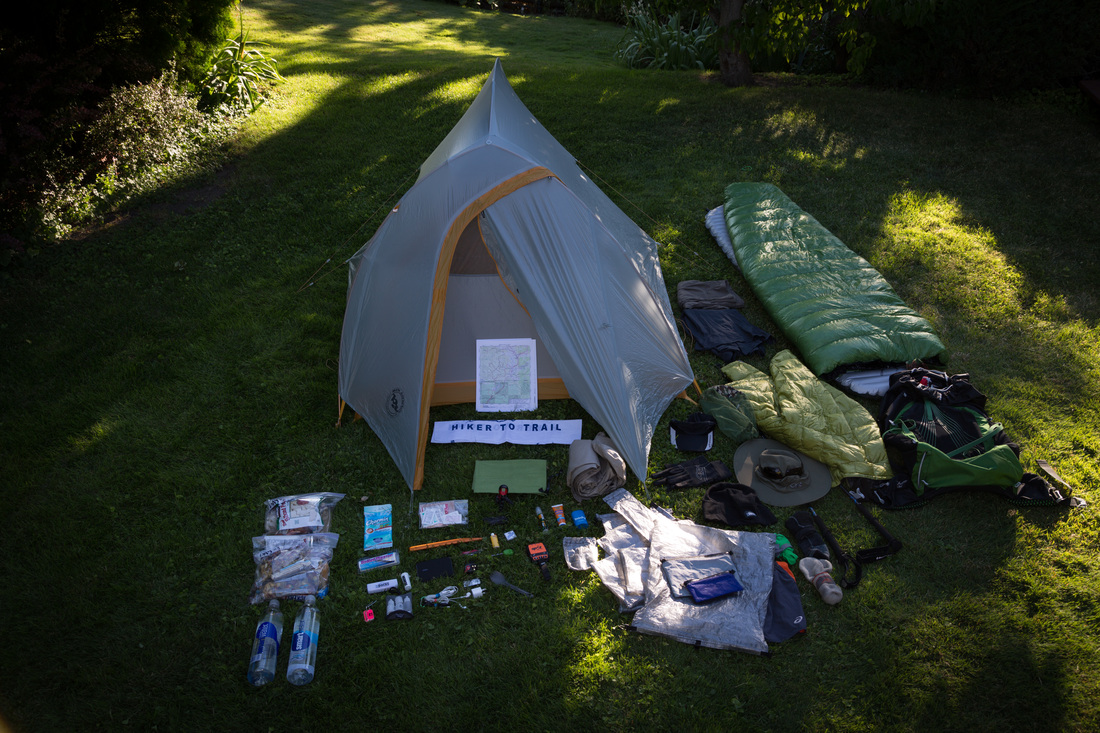
All gear + 2 days of food for PCT: Oregon
Picture
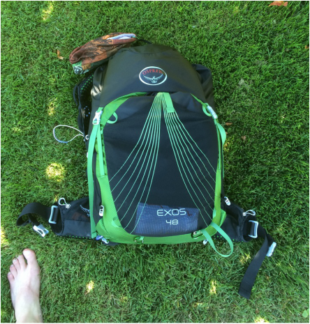
Somehow fits into this little 48L pack!
2 Comments

PCT: Oregon FAQ's

6/17/2014

4 Comments

 
Picture


Naturally, throughout the long planning process of my upcoming trek, I have had the opportunity to address a slew of questions.  What if bears eat your face off?  What if squirrels take you in and raise you as one of their own?What if you run out of toilet paper?  Although I'm not going to answer the aforementioned questions, I will answer some others that have been asked fairly frequently.

What is this "PCT" you keep speaking of?
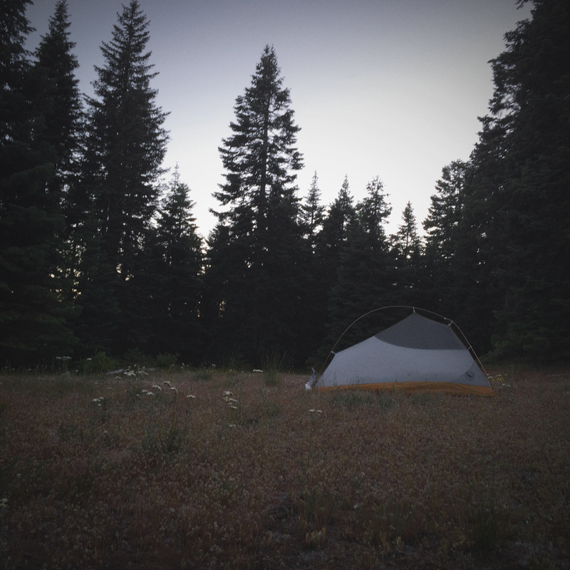
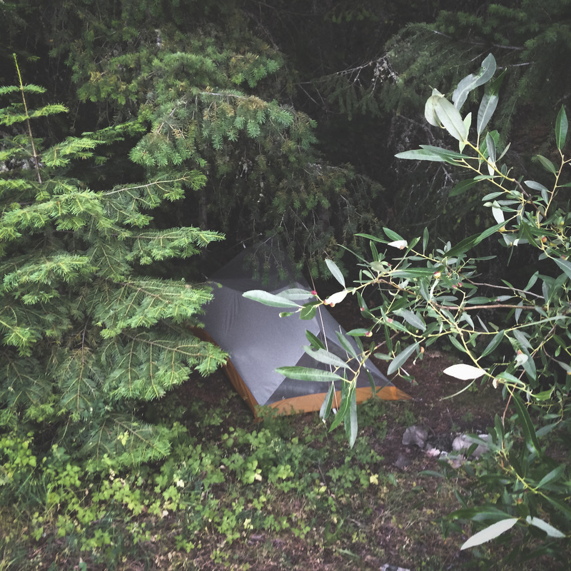
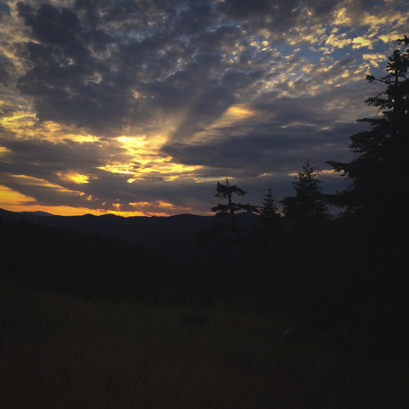
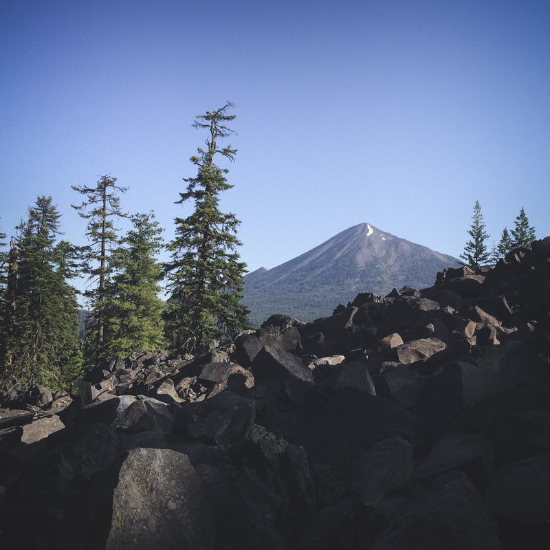
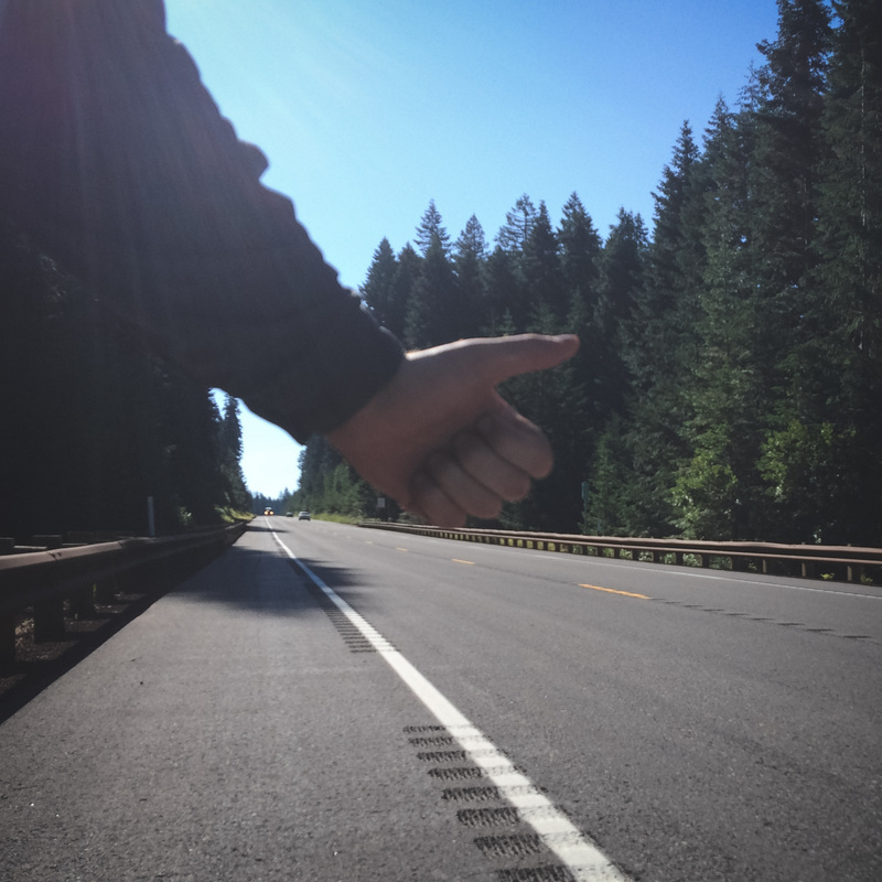
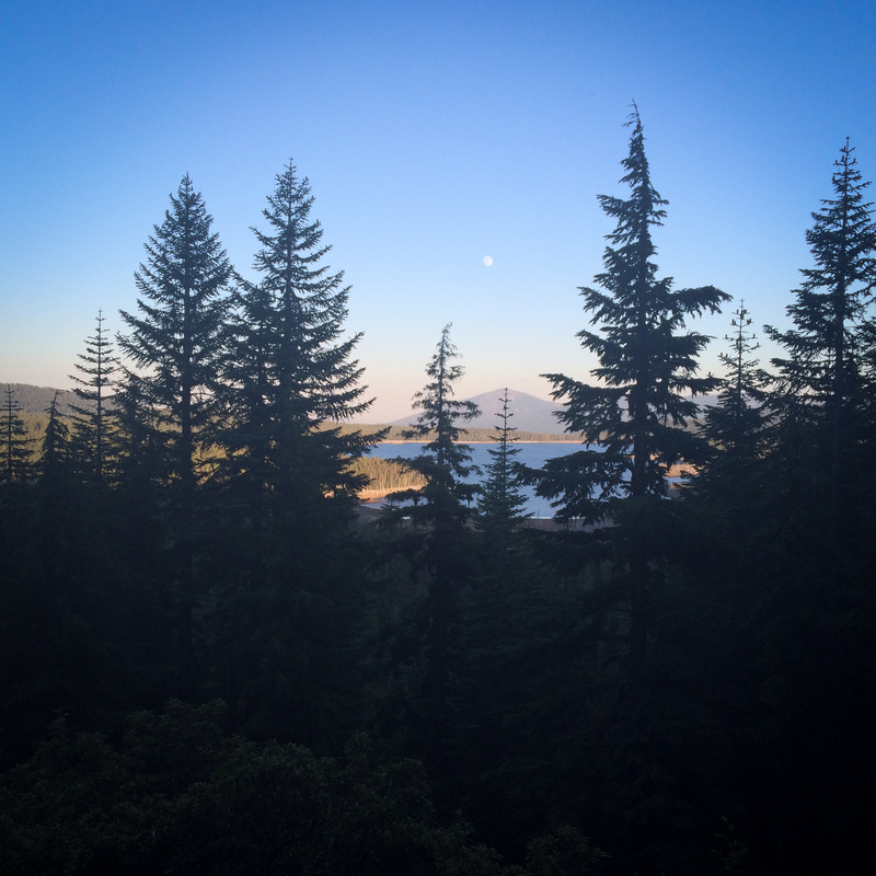
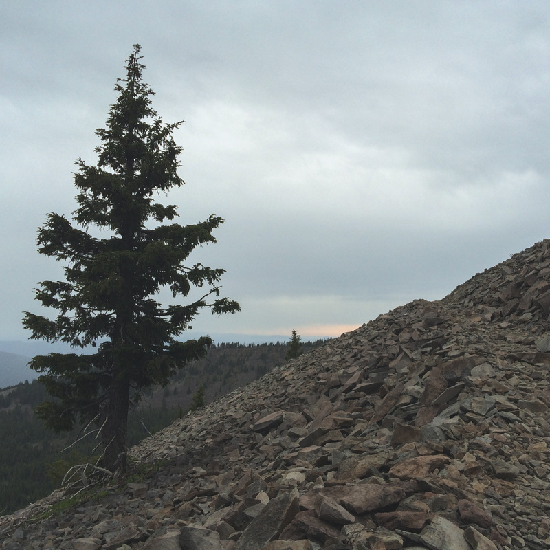
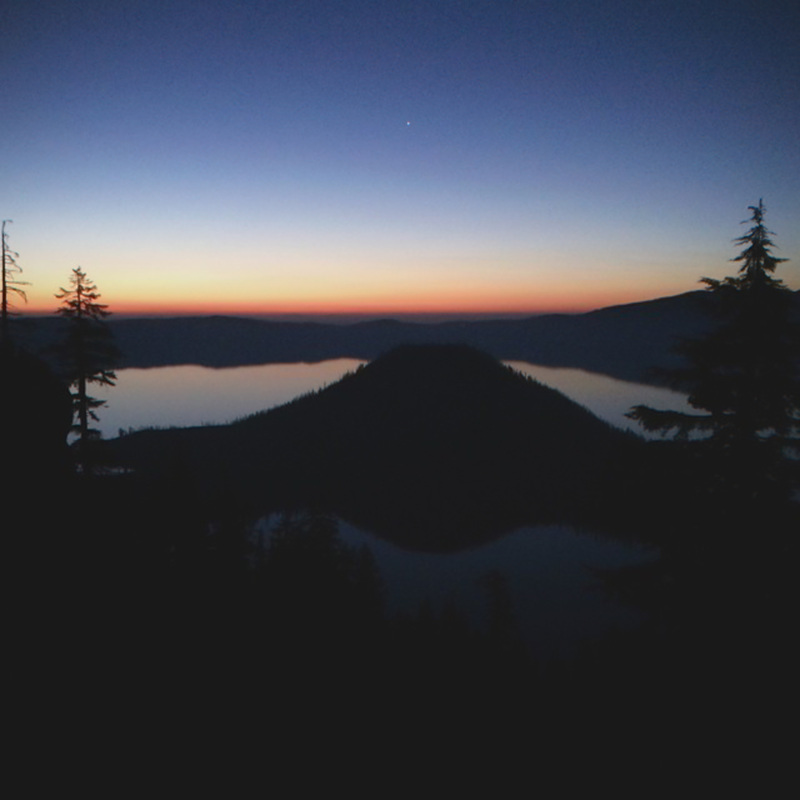
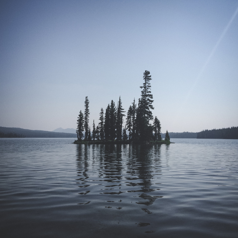
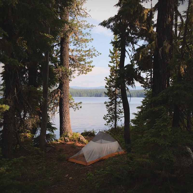
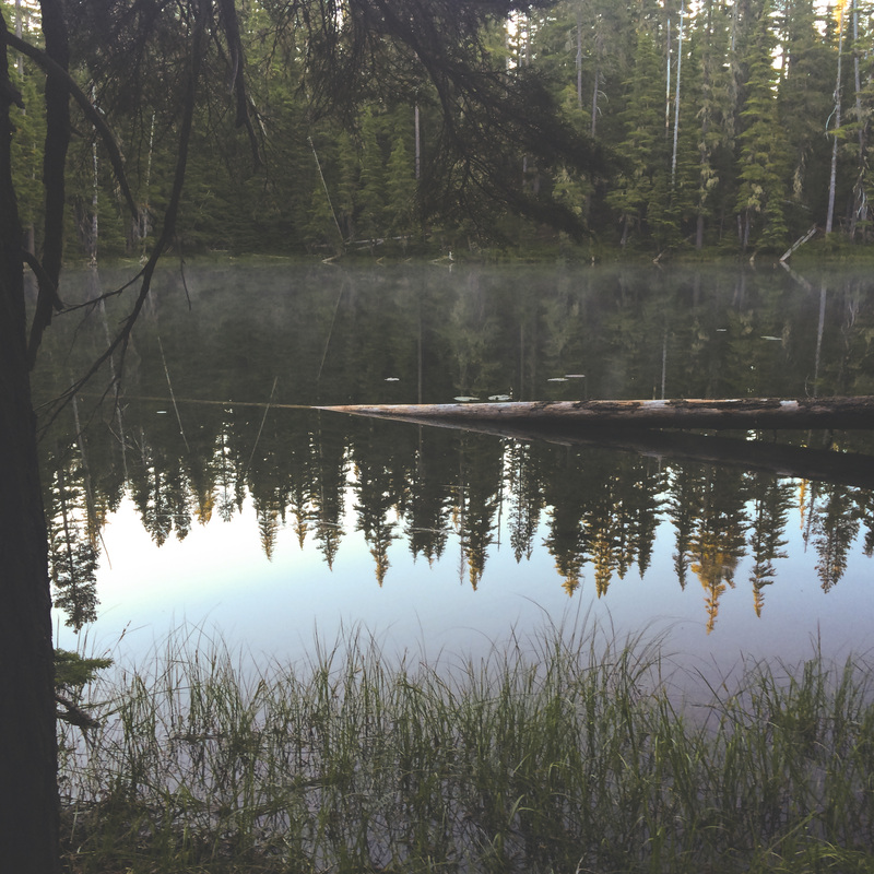
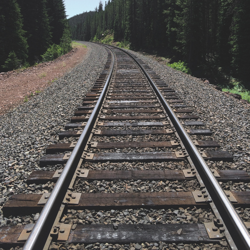
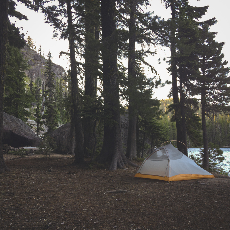
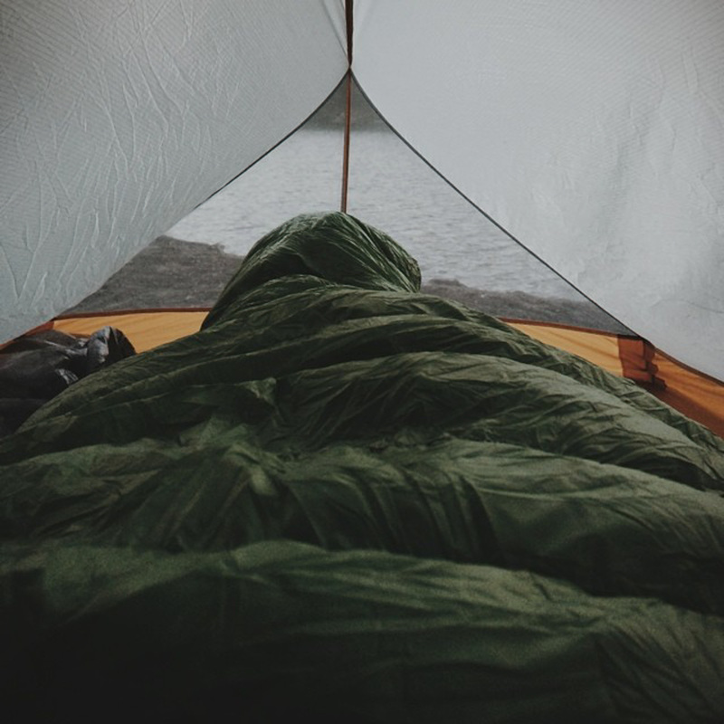
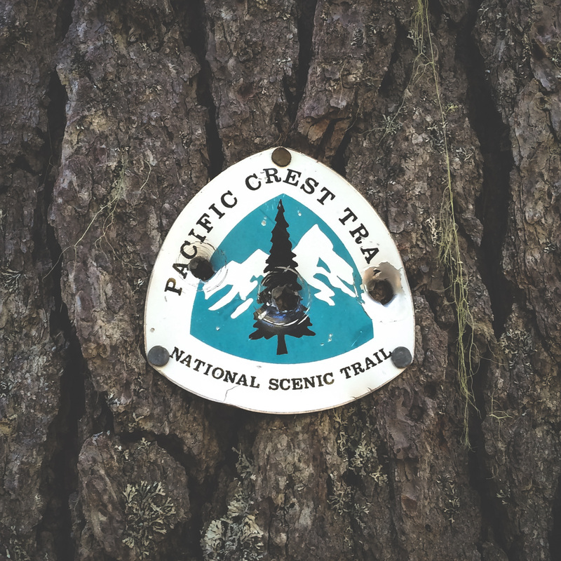
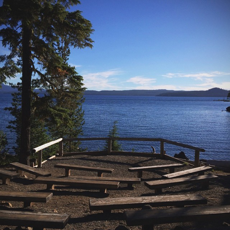
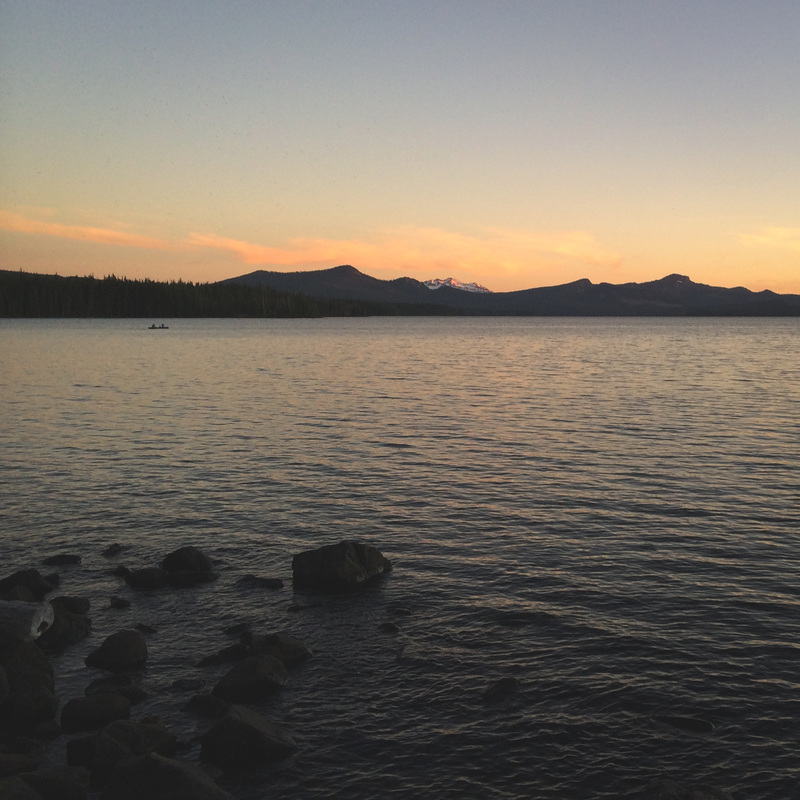
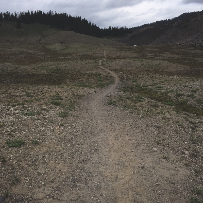
The "PCT" is short for the Pacific Crest Trail.  It's a larger than life trail system that stretches along the West Coast of the US of A from Mexico to Canada.  "Many" individuals attempt and complete the entire trail in one through-hike, while others complete sections individually.  As for myself, I aim to tackle the Oregon section, which is 456 miles officially, but my version will be a bit longer than that.   Now, in regards to the entire trail, when I say "many", it's obviously relative.  For those that love facts, to date, about 2,973 have completed the entire trail, but i'm certain that those numbers are going to sky-rocket due to increased publicity.

How many miles a day will you be backpacking?
This will vary greatly depending on the day.  My biggest days will be 30+ miles, while I have a couple that are 11 and 13.  My average miles per day will be around 22.

Where will you start/end?
In the spirit of truly backpacking across Oregon, I will start a few feet across the California border along the PCT. I will be dropped off here by family on the eve of July 7th.  My finish line will be in the state of Washington, just across the iconic Bridge of the Gods in the beautiful Columbia River Gorge.

Why are you doing this?

I feel like this is a question on most people's minds, whether they actually ask it or not.  The truth is, I'm doing this for a slew of reasons.  However, what I've discovered is that people either understand the appeal and draw of something like this, or they don't.  For those who don't, there's really no point in trying to explain it, as people's mindsets can be very different.  For those who absolutely need some concrete reasons... Here's a few:
Opportunity
Experience
Accomplishment
Timing

Here's the thing though, the primary reason why I'm ABLE to do this is because my wife encouraged me to.  How awesome is that?   Answer: VERY

Are you trying to find yourself?
No.  I found me many moons ago.  I'm certainly BEING myself, but not trying to "find" anything. (Except for Sasquatch)

Can I meet you on the trail?
Please do! Just be prepared to experience a stench unlike any other you've encountered.  Besides just for fun, the ROUTE portion of this blog was/is meant to aid with the planning process for friends/family who want to pop in and say hi!  Specific places i'll be AND specific dates i'll be there are listed for the entire route and can be found HERE.  Also, bring snacks.

Why isn't Jesse coming along?
Jesse enjoys being cozy, warm and comfortable.  In that order.  The PCT doesn't allow any of those requirements regularly.  Easiest decision of her life.

Won't it be hard to be away from your wifey that long?
Here's some good news.  Jesse will be joining me once every week during my "0 days", or days with no hiking, just rest.  We will enjoy time together at Crater Lake, Waldo Lake and Olallie Lake, with Timberline Lodge being an optional stop.  There's no way I could stand being away from Jesse for 25 days, which luckily, I don't have to!

Is anyone going with you?
Negative.  This is a solo trip.  This is a bit alarming to some folks, but I knew this would be the case from the start.  I enjoy the solitude.  It's a pretty special and spiritual time for me.  With that being said, others are certainly invited to join me, it's just extremely difficult for most to be able to take a month off of work and make the time.  I totally understand that, and thus, solo it is.

Why such a regimented itinerary?  Why don't you just "play it by ear" each day?
Primary Reason: As mentioned earlier, i'm really not excited about being away from my wife. Although we'll be seeing each other every week, it's going to be difficult.  Also, being that my wife is working right now, her days off are limited, so the trip must be planned accordingly.
Secondary Reason: I love over-planning stuff.

What if you get lost?
Then I will get un-lost.  I'm bringing a number of navigational and route-finding aids with me.  Trail maps, topography maps, and a perfectly capable GPS system with the route built-in. Here's the thing though.  The PCT is very well marked.  I'm making assumptions here, but I highly doubt that I'll even need the aforementioned items for actual route-finding along the trail more than a few times.  

I get it, but what if you DO get lost?
I will also be carrying a Spot Satellite Messenger with me on the entire trail.  This serves a variety of purposes.  Not only does it provide live tracking to those following my conquest, but it also has built-in SOS features.  With satellite technology, a press of a button alerts first responders and the appropriate SAR (Search and Rescue) teams of my exact position.  SCIENCE!  Additionally, just because i'm in the sticks doesn't automatically mean I won't have cell service.  There are many portions of the trail with decent reception.  

How are you going to keep your devices charged?
By harnessing the power of the sun!  You know that big fiery ball in the sky?  It has the ability to produce some real-deal energy! I will be carrying a small solar charger with me on the trail.  Not only does it charge via solar power, but it has an internal battery that will store said power for multiple rainy days (literally).  With that being said, my battery consumption will be minimal.  My phone will be in "airplane" mode for the large majority of the trip, and will only be used lightly for various tasks, including frequent calls to my wife to tell her how smokin' hot she is.  Note: Being that this trip is through OREGON, I certainly am not RELYING on the sun for power, just using it when able to keep external batteries topped off.

What will you eat?
Calories.  I will be consuming calories.  This seems like a lazy answer here, but it's really true.  I will be shoveling food into my inferno of a digestive system as quickly as possible.  It is near impossible for a person to gain weight while backpacking many miles a day, so for the sake of ease, I will eat when I'm hungry.  What will I eat exactly?  Lots of things.  I'll make sure i'm getting all the necessary vitamins, and will eat a hot meal every other day or so. (FANCY!)  In terms of calories, I'm gunning for about 3,500 a day.  These calories will come from Mangos, Coconut, Quinoa, GORP (Trail Mix), meal bars, dried meats, almonds, CANDY, freeze-dried meals, freezer-bag meals, etc. For an extra treat, I'll even hitch into town occasionally and eat every hamburger within sight. (Hamburglar style)

Are you carrying 25 days worth of food for the entire trip?
No way.  The most food i'll be carrying is about 5 days worth.  This is accomplished a few different ways.  First, Jesse will be meeting me once a week and bringing a new supply of food.  Additionally, some food will be sent ahead to various Post Offices and resort areas that agree to hold packages for pickup.  By doing this, food weight can be kept as low as possible and if I'm in need of any additional supplies/gear replacements, they can be sent to specific points along the trail as well. Essentially, I'll have an address for the 25 days of backpacking, it's just that the address will be changing every few days.  Another note, I'll also purchase some food along the trail.  Whether this means I'm hitching into town to grab a hearty meal or buying Nutter Butters for $6 each at a resort store, these options will inject a bit of variety into my diet.

What about water?  Are you a camel?
No, I'm not a camel.  But I respect them.  Using a variety of resources, I have managed to map out the location of reliable water resources along the entire trail.  There are some stretches of 25+ miles between water sources, but for the most part, they're fairly plentiful.  In regards to the entire PCT, California is a whole different story in regards to water availability, so i'll pour some out for those through-hikers still in Southern CA.  In regards to making water safe to drink, I'll be filtering it along the trail.  I'll be using either a filter or purification tablets, but haven't quite decided yet. Only time will tell. Ultimately, yes, my drinking water will be safe, and yes, I will drink roughly 57 gallons per day.

What kind of sleeping bag/backpack/stove/shoes/clothes/etc will you be using?
I'm almost done compiling my Gear List.  This will feature the make/model/weight of every piece of gear that I'm bringing along with me on the trail.  A ridiculous amount of time and research went into compiling and gathering my gear.  Luckily, I had quite a bit of the equipment already, making the total bill manageable.  For those of you who like gear talk, this may fascinate you.  For the rest of you, I promise I'm not a weirdo. This gear-list will also address gear costs, as I have been asked just how much a full-gear compliment costs for a trip like this.  Luckily, I had a large majority of the equipment already, but the itemized list will certainly give you an idea.

How heavy will your pack be?
I really didn't think this would happen to me, but I have turned into a full-blown Weight Watchers spokesperson in regards to my pack weight. We're talking "carve your toothbrush down to a nub to save 2 grams" type of stuff.  As a result, my base-weight (everything but food, water and fuel)  will be right around 10 lbs.  Don't get me wrong, food and water will add a whole lot of weight, but I'm very proud of my base-weight.  I'm no Joe Valesko, but I'm proud of what I've been able to put together.

Wait a second, 10 lbs?!  But what about this/that/the other thing?
If any of you have ever been in Boy Scouts, you probably learned to "Be Prepared" by bringing just about anything and everything you could POSSIBLY need while on the trail.  Although I understand the merits and reasons for teaching this to the young lads, in my opinion, it is absolutely not practical for long-distance backpacking.  When you're carrying huge amounts of weight on your back for many miles and moons, the only thing you're "preparing" yourself for is pain, discomfort and potential injuries.  Yes it's true, my rad boom-box probably won't be with me during the month of July.  Sorry boom-box.  For more information about ultralight backpacking practices and motivations, here's a solid read.  I'm completely sold.

Where will you sleep?
So many different places.  I did my best to plan my route so that as many camps as possible have interesting settings/views.  However, being that the priority of my various camps is their proximity to water, some camps will be pretty boring.  I'll be sleeping in a small tent most nights, but will occasionally Cowboy Camp (under the stars) when the weather/bugs permit(s).

Where/how often will you bathe?
Almost never.  I will smell like a full-blown hobo.  Mounds and mounds of apologies to those that will have to experience the stench first-hand.  HOWEVER, occasionally I will be camping at a body of water capable of providing a pretty decent bath.  Naturally, this will only fuel my "full-blown hobo" appearance and designation further.  Rest assured however, none of the aforementioned lake-baths will take place in areas like this.

How will you do the # 2?
Step 1: Dig a hole
Step 2: Bombs Away
Step 3: Cover hole
Step 4: Walk with renewed confidence

What if a bear/cougar attacks you?
Then a couple things could happen.  First, if I survive, I will have an amazing story to tell.  Second, if I don't make it, I will have an amazing story for someone else to tell.  Let's get real though, the bush isn't crawling with predators whose primary food source is humans.  Thinking that simply being/camping outside means that bears/cougars will be constantly hunting you is silliness.  Will I be smart in regards to food storage around camp and camp placement?  Of course.  I'm not gonna go all Timothy Treadwell or anything, but the feeling that I'll be in imminent danger just because i'm in the woods is fed by fear and misinformation. (This last quote is what will be printed next to my obituary)
Just for fun though, in my opinion, here are 10 things i'll likely encounter on the trail that are WAY more dangerous than bears/cougars.
1. Lightning
2. Hunters
3. Giardia
4. Dehydration
5. Rattlers
6. Cold
7. Ledges
8. Bugs
9. Heat
10. Sasquatch

In short: Rest easy...I'll be just fine! 

Aren't you worried about the dangers you listed?
Prepared, yes.  Worried, no.  Regardless of actual danger levels, in my mind, the one that makes me most uncomfortable is the potential of rattlers being along the trail.  Any animal that can slink along the ground like snakes do is a completely unacceptable creature in my opinion.  They were designed to make me uncomfortable, and that they do.  In the event of the extremely unlikely bite from a rattlesnake, I'll employ my venom extractor and, depending on my location, promptly send as SOS message via GPS Messenger.  But just like the presence of bear/cougar danger, the odds are ever in my favor in regards to the likelihood of a snake bite in the sticks.  Interestingly, a rattlesnake bite is a rarity that my Dad experienced while he was a young chap growing up in Montana.  Although not encouraged by today's standards, doctors suggested that my Grandpa's decision to suck the venom out of my Dad's wound could have very well saved his life.  The more you know!

What type of training have you been doing?
As all of friends and family know, I have really been putting in the miles lately. I've been averaging 40-60 miles per week for the past few months, with almost all trips including around 3,000-4,000 ft in elevation gain. Living in the Gorge has many perks, including an excellent assortment of trails to chose from with varying difficulty.  Naturally, one can't fully prepare for full-time backpacking by completing assorted trips, but I feel that I'm about as prepared as I can be.  Regardless of what I had/have done to prepare, I will still be waddling around camp like a 200 yr. old man at the end of the longer days.

Are you a hobo?
You've read me like a book.  Respect

Wait, I have more questions!
There's hundreds of potential questions that can be proposed regarding trips like this.  Feel free to post any additional questions in the comments and i'll make an effort to address them all!

Onward!

Mitchell


4 Comments

Pacific Crest Trail: Oregon

6/8/2014

0 Comments

 
Picture
On December 25th, 2013, I casually opened the most exciting Christmas gift that I've ever received.  My hand-held Aladdin video game had previously held this title for many moons, but this year was different.  My wife had given me a PCT Guidebook.  As a simple book, it provides an interesting compilation of data relating to the amazing Pacific Crest Trail that spans 2,650 miles along the Western United States from Mexico to Canada.  Pretty amazing right?  As you can probably assume, Jesse's gift was more than just a book.  


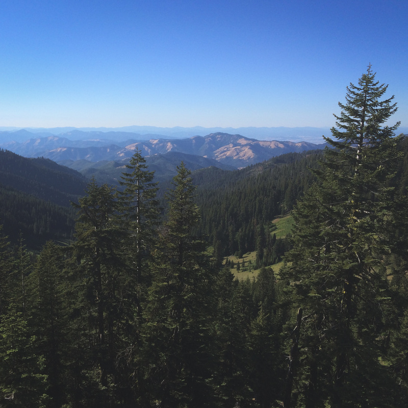
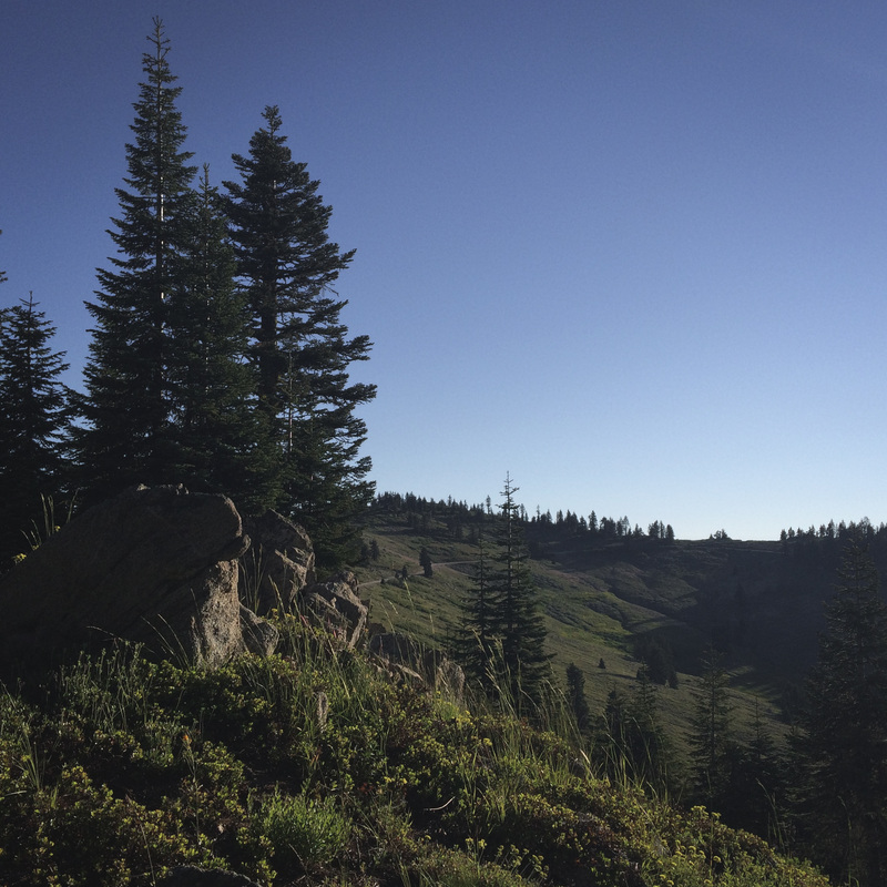
This gift was both a book and a blessing.  Jesse gave me the green-light to attempt a solo backpacking trek across the entire Oregon section of the Pacific Crest Trail.  Jesse had already established a strong argument for multiple wife of the year awards, but after this go-ahead, her trophy is secured for the rest of time.  This had always been something I was interested in throughout our marriage and long before.  Naturally, the fascinating combination of discovery and fatigue attached to long-distance backpacking has romanced myself and many others.  Her blessing was a complete surprise to me. I generally dislike surprises, but this was an obvious exception.

Officially, the Oregon section of the PCT is 456 miles.  My trip will be slightly longer than that due to a planned variation on the last day of trekking.  Because I grew up hiking and backpacking the Eagle Creek Trail in the Columbia River Gorge, finishing my trek via this alternate route is the natural and nostalgic decision.  After researching oft-traveled routes and variations by others, I've found that most PCT through-hikers do the same thing.  The Eagle Creek variation is just THAT good.

There are many different approaches to long-distance backpacking.  Some prefer to plan almost nothing in regards to their daily mileages, while others prefer to plan the entire trip very carefully and meticulously.  I tend to fall into the latter group.  While some may argue that this takes the "fun" out of a trip like this, so far, I have found that the opposite is true for ME.  The planning process has been fantastic.  It has consumed me.  After scouring the entire trail across Oregon via a slew of available resources, I feel as if I've already completed a virtual version of the trip, but sitting in an office chair is much different than packing your home and food across Oregon.  I can't wait for the challenge.

Departure day is July 7th.  In the meantime, I'll be adding a huge amount of information to this site. In my preparations, other people's accounts and experiences leading up to and completing their own trips has informed and encouraged me.  I hope to provide the same courtesy to those that follow me.

Here's another factor regarding the trail.  It would be RAD to see you on it!  Although I oft-times prefer to be alone out in the sticks, 25 days straight is something entirely different.  Check out the "route" portion of this blog to check out exactly where I'll be on specific days.  If you're capable of overlooking the awful stench that will be my constant companion on the trail, I'd love to see you!

As mentioned, updates and new information will be a-plenty leading up to the trek!  I've got a whole lot to cover.  Gear lists, gear reviews/suggestions, FAQ's, planning processes/tools, etc. Naturally, I'll be updating this page during my journeyings as well.  You'll be able to track my progress live and partake of insights along the way.  Barring any unfortunate injuries or mishaps, we are a complete GO for launch.  Stay tuned!

Mitchell


0 Comments
    Picture

    PCT: Oregon

    VERY FUN FACTS
    Who: Mitchell
    What: Solo Backpacking
    When: July 7-31, 2014
    Where: Across Oregon
    Why: 100 Reasons
    Miles: 458


    Route

    Picture
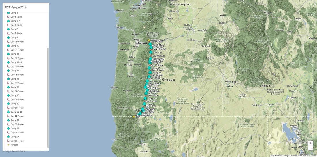
    This took me far too long to compile, but it provides valuable information on my planned whereabouts for every day of the trek!

    GEAR LIST

    Detailed and itemized list of gear for PCT:Oregon

    Categories

    All
    Gear
    Information
    Overview
    Trip Summary


    Archives

    November 2017
    September 2014
    July 2014
    June 2014

Powered by Create your own unique website with customizable templates.